Fort Clinch was constructed on the north end of Amelia Island beginning in 1847 as a part of an effort at coastal fortification by the U.S. government, in response to the War of 1812. The fort was not completed by the time it was occupied by Confederate troops at the opening of the Civil War. Soon after it was taken by Federal troops and served as a base of operations for the Union war effort on the Florida and Georgia coasts. Except for a short period of activity during the Spanish-American war, Fort Clinch was essentially abandoned until restoration began on the facility as part of the effort to rejuvenate the economy after the Great Depression. After restoration of the fort, the land was included in a purchase of more than 250 acres by the state of Florida, which was eventually organized into Fort Clinch State Park. The park and the fort have been open to the public since 1938, except for a period of time during World War II, when the fort served as a communications post for the U.S. military.
The site of Fort Clinch is located on the north west corner of Amelia Island, where the Amelia River and the St. Mary’s River come together in Cumberland Sound. The western part of the area around the Amelia River and Egan’s Creek is very low lying while to the east of the fort lies a ridge of dunes that is fairly high for the area. The western area is highly vulnerable to inundation due to sea level rise. The area immediately adjacent to the fort is very low and by the end of the century will likely see permanent or semi-permanent inundation. The fort itself may not be flooded as it sits on a site that is at roughly 6-7ft above sea level and the entrances to the fort are raised. Though the fort may not be flooded, it will be much more vulnerable to erosion and damage from storm surge as sea levels rise. With proper management and resiliency plans that take into consideration projected sea level rise and storm surge predictions, it is certainly possible that Fort Clinch can be preserved for visitors throughout the twenty-first century.
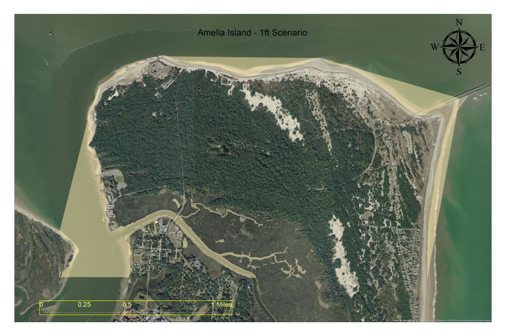
1ft Scenario
In the event of a 1-foot rise in sea levels, the northern end of Amelia Island will see some minor shoreline loss, particularly around Egan’s Creek.
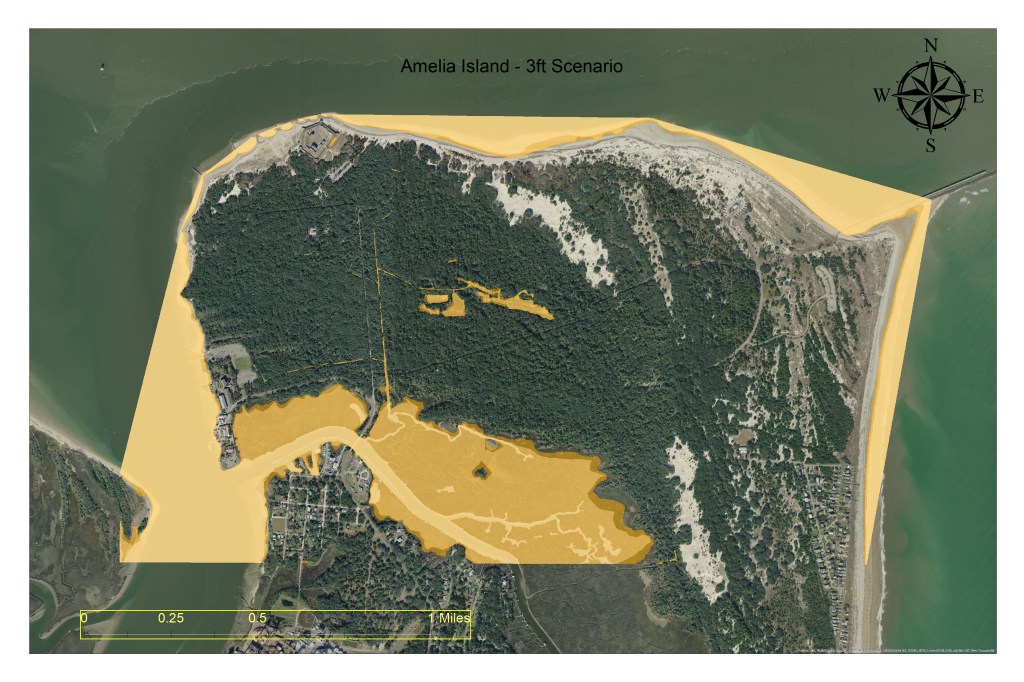
3ft Scenario
At 3-feet of rise, the area directly north of Egan’s Creek is subject to minor inundation, but the area adjacent to Fort Clinch will likely be free of standing water.
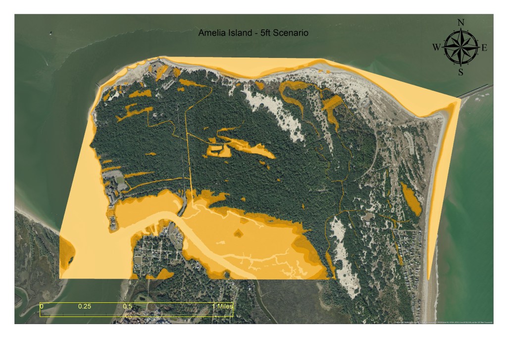
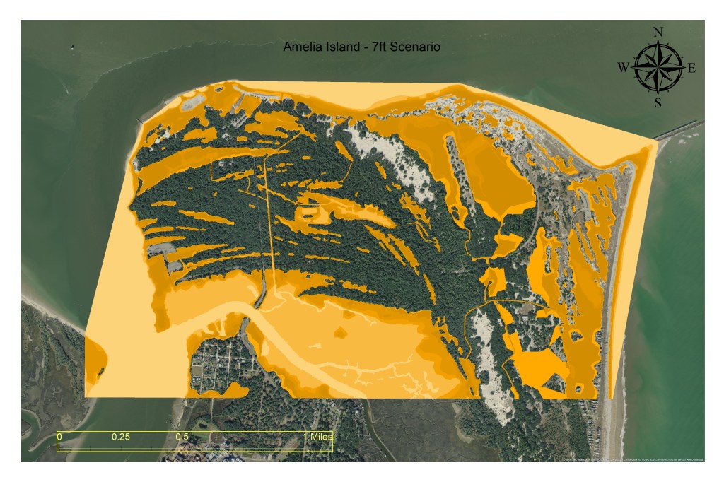
5ft Scenario
Under a 5-foot rise scenario, there will likely be minor additional inundation north of Egan’s Creek and in areas near drainage canals, but permanent flooding on the majority of the island is not likely.